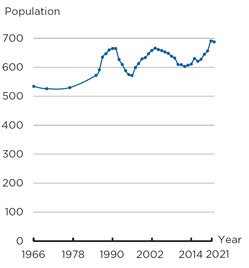
Eiði, mentioned in Hundabrævið, has 688 inhabitants, covers 48 merkur and is the largest markatal settlement on Eysturoy; 4 merkur are copyhold land and 44 merkur are freehold land. The copyhold land is owned by a single copyhold tenant.The sheep herd consists of 1,520 animals.
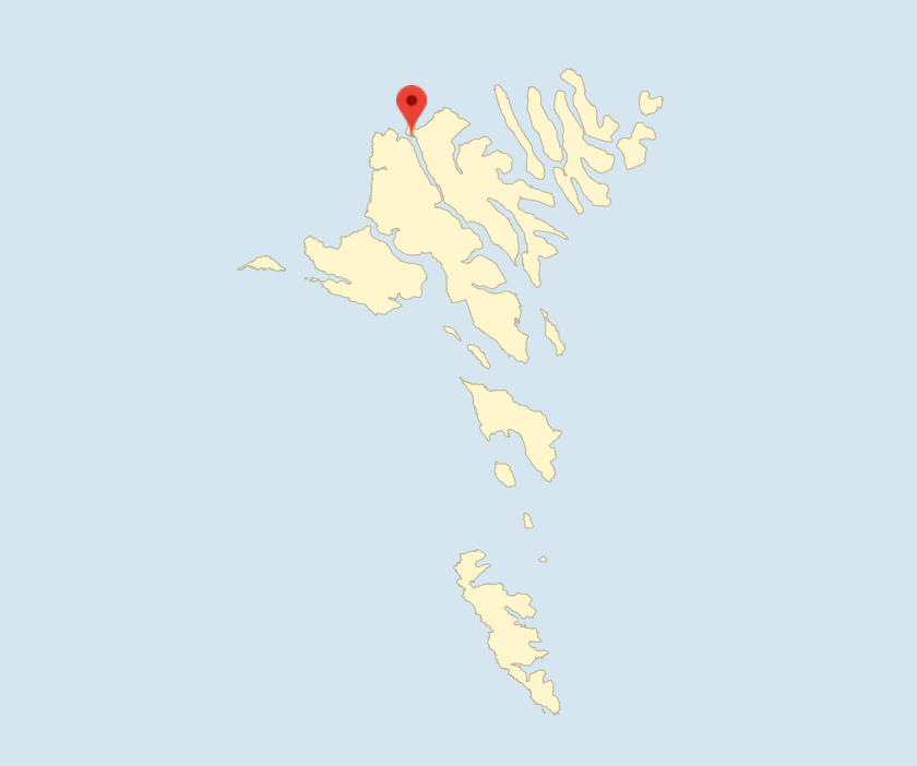
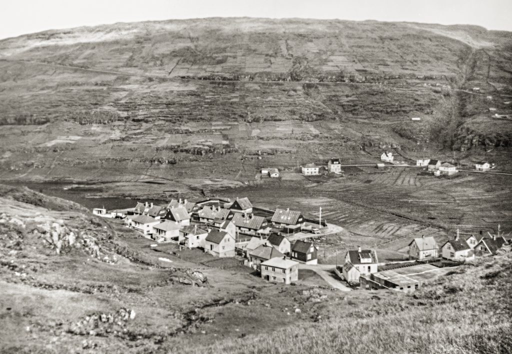
Eiði lies in a depression at the foot of the Eiðiskollur or Kollurin peninsula with access to the sea on both sides. The settlement extends up the south side of Kollurin.
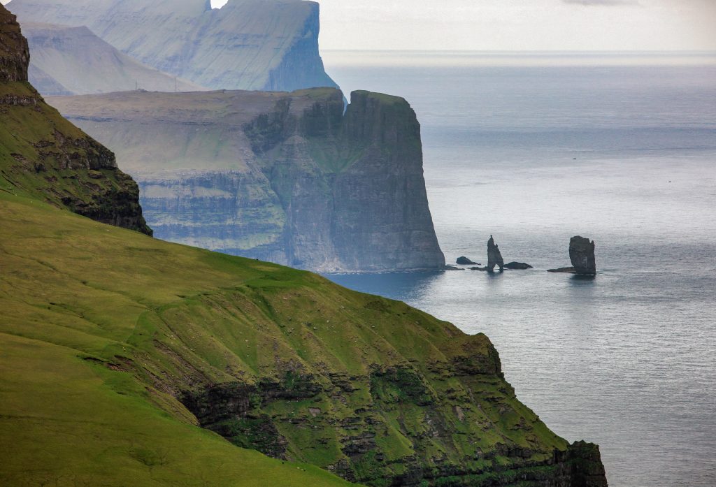
Northwest of Eiði, off Kollurin, stand the two mighty sea stacks called Risin and Kellingin (the Giant and the Witch) at 71 and 69 m, respectively.
Since 1823, the 352-m high Eiðiskollur has been protected from sheep grazing in summer. That is one of the reasons for the area’s special flora, with plants such as mountain avens, golden cinquefoil and small white orchid (Pseudorchis albida). Bog bilberry grows in abundance and field gentian is much more common on Eiðiskollur than elsewhere in the Faroe Islands.
HAGSTOVA FØROYA
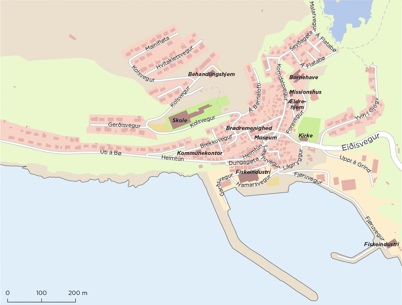
Archaeological findings at Durhús, which is located in the middle of the village, dates the village to the Landnam period. At that time there was just one farm, Eiðisgarður, which was divided into two farms during the 11th century, after the shieling at Argisbrekka had been abolished.
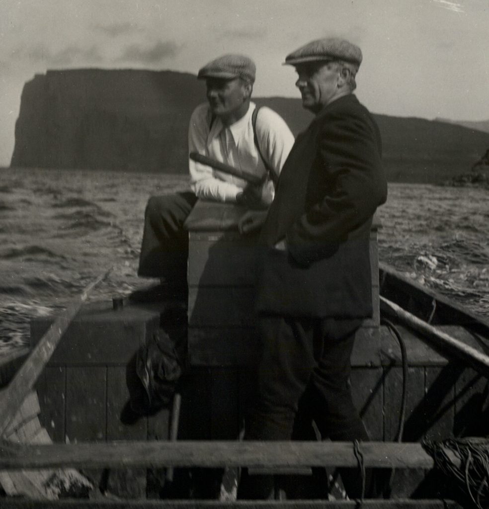
Eiði is close to the Faroe Islands’ northern fishing banks and has always offered excellent fishing opportunities. Eiði therefore experienced considerable population growth in the 19th century, and in 1880, the village, with its 500 inhabitants, was the second largest in the country. Decline in local coastal fishing in the 1900s led to a fall in population, but it has since grown again.
Boats still come from other villages during the fishing season, and the village established a jetty and breakwater relatively early on, which have since been extended several times, so that the village now has a good port. The other small villages that belong to the municipality also have smaller ports. Relatively early, the village had a fish factory and several fishing ships. There are several companies in the municipality.
The power company SEV has since 1986 expanded its electricity production with a hydropower plant in Eiði by damming Eiðisvatn, from where tunnels have been drilled for water supply. There are also plans to establish a wind farm.
Since the very early days, the church and the cemetery have been placed in the middle of the village. A new church was built in 1881, designed in the Romanesque style by the Danish architect H.C. Amberg and is prominently placed at the highest point.
Eiði has had school teachers since 1834, and the first school building was built in 1874. The current school building was built in 1965. It was expanded with a sports hall in 2001, and in 2020, an 8.5-m climbing wall was added. The old gym was converted into a music school and cultural centre in 2016.
Senior co-housing was established in 1999, and a kindergarten opened in 2008.
A football stadium and a new village hall were built in 2018.
The distinctive house Látralonin was built in stone by the farmer Poul Joensen, called Pól á Látrinum, in 1841‑42. He accompanied the chief administrative officer, C. Pløyen, on the famous study trip to Shetland in 1839. The listed house now serves as the village’s local museum.
Since 2014, the municipality has organised an autumn festival, Heystfagnaðin, in October every year, where traditional Faroese village life is celebrated.
Hotel Eiði welcomed its first guests in 1983, but was closed in 2011, and the building now houses a rehab clinic for young people with alcohol and drug addiction.
Eiði Camping opened in 2015 on the village’s disused football field facing the sea.
In 1975, a memorial was erected to men who have died at sea, made by Fridtjof Joensen; the scene is a mother with her little son.
The artist Niels Andreas Kruse, who lived in Eiði, was a pioneer in Faroese landscape painting. His granddaughter, Sigrun Gunnarsdóttir, who has a studio in the village, is one of the Faroe Islands’ wellknown painters.
The municipal doctors in Eiði
In 1912, the first municipal doctor with a medical practice settled in Eiði. In 2017, the medical practice moved to a more central location in the medical district in the neighbouring village of Norðskála.
Over time, three municipal doctors in Eiði have distinguished themselves with more than just their medical practice: Rasmus K. Rasmussen, municipal doctor 1920‑52, made important observations regarding psittacosis or parrot fever, which was transmitted to humans via the northern fulmar. Along with other observations in his medical articles, including a work on Faroese traditional medicine, Gomul Føroysk Heimaráð (1959), this to his being appointed an honorary doctorate at the University of Copenhagen in 1950.
Petur Reinert, municipal doctor during the periods 1960‑75 and 1978‑86, distinguished himself as a local entrepreneur within the fishing industry. He was general manager of the fish filleting factory Norðís and shipowner from 1986, Minister for Fisheries and Municipalities 1975‑79 and member of the Løgting in the years 1980‑84, representing Tjóðveldisflokkurin (now Tjóðveldi).
Magnus á Stongum, municipal doctor 1986‑2008, is a well-known songwriter and singer, and he is a guitarist and singer in the band Tinganest. He also became an important figure in the local football club EB/Streymur.
Radar station and Loran station
On the mountain Eiðiskollur on Eysturoy, the British built a radar station during World War II. The radar system was one of the first developed by the British military and was therefore kept secret.
The construction provided work for some 100 men, and during the period 1942‑43, 30‑40 Royal Air Force soldiers were attached to the station until it was closed down. The ruins can still be seen.
On Suðuroy, at the 200 m high Eggjarnar, the British engineer corps built a Loran (Long Range Aid to Navigation) station, which was commissioned in October 1943 and manned by British Royal Air Force personnel. The navigation system was used by ships, submarines and airplanes. Denmark took over operation of the station in September 1946 and operated it until it was closed in December 1977. The buildings can still be seen.
In the area on the island of Eysturoy at Eiði and the former British radar station, a new Danish manned Loran-C facility was built in 1959‑60, initially for military use, including the American Polaris programme with nuclear-armed submarines in the North Atlantic. Satellite-based navigation systems later made the Loran-C system redundant, and the station with the 190.5 m high antenna mast was decommissioned in 2019. The seven black and white houses built for the staff at the lake Niðri á Vatn, the so-called Kardemomme By, are still standing and have now passed into private ownership.
On Sornfelli, just north of Tórshavn, a radar station was built in 1959‑62, manned by more than 100 people. The radar stations was supposed to warn of aircraft and rocket attacks from the Soviet Union. It was closed in 2007, and the building facilities were handed over to the Faroese Home Rule in 2013. In 2022, at Denmark’s request, the Home Rule Government agreed to the re-establishment of a new radar head for warning of potential aircraft and missile attacks at the same location.
BASED ON UMHVØRVISSTOVAN
Further reading
- Eysturoy (Island)
- Æðuvík (Settlement)
- Elduvík (Settlement)
- Fuglafjørður (Settlement) and Fuglafjarðar Municipality
- Funningsfjørður (Settlement)
- Funningur (Settlement)
- Gjógv (Settlement)
- Gøta (Settlements)
- Gøtugjógv (Settlement)
- Hellurnar (Settlement)
- Kambsdalur (Settlement)
- Kambsdalur (Settlement)
- Lamba (Settlement)
- Lambareiði (Settlement)
- Leirvík (Settlement)
- Ljósá (Settlment)
- Nes (Settlement) and Nes Municipality (Eysturoy)
- Norðragøta (Settlement)
- Norðskáli (Settlement)
- Oyndarfjørður (Settlement)
- Oyrarbakki (Settlement)
- Oyri (Settlement)
- Rituvík (Settlement)
- Runavík (Settlement) og Runavíkar Municipality
- Saltnes (Settlement)
- Selatrað (Settlement)
- Sjóar Municipality
- Skálafjørður (Settlement)
- Skáli (Settlement)
- Skipanes (Settlement)
- Søldarfjørður (Settlement)
- Strendur (Settlement)
- Sunda Municipality
- Svínáir (Settlement)
- Syðrugøta (Settlement)
- Toftir (Settlement)
- Undir Gøtueiði (Settlement)
Read more about The islands, towns and settlements