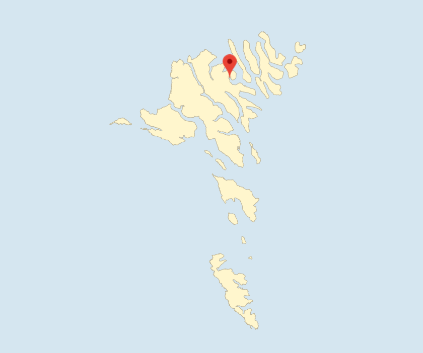

Fuglafjørður, together with the outlying village of Hellur and Kambsdalur, constitutes Fuglafjarðar Kommuna.
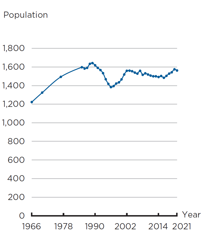
The markatal settlement of Fuglafjørður, mentioned in Hundabrævið, has 1,561 inhabitants and covers 32 merkur and 1 gyllin. 6 merkur are copyhold land, and 26 merkur and 1 gyllin are freehold land. The copyhold land is leased by one copyhold tenant. The sheep herd consists of 1,529 animals.
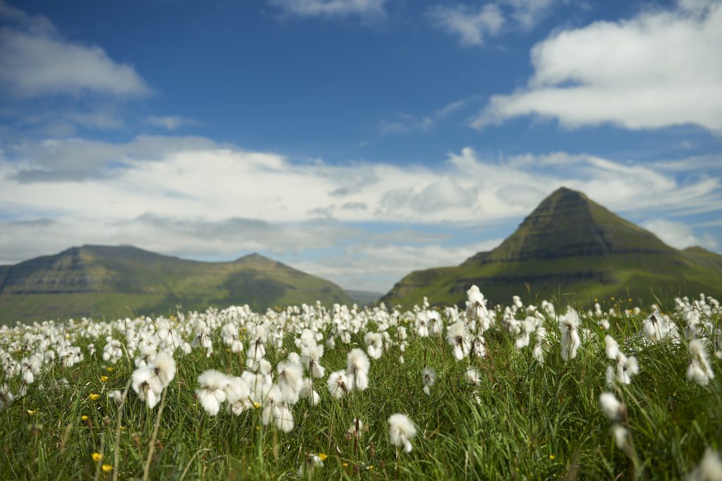
The village and the fjord lie well protected from most wind directions. It is surrounded by high mountains, the highest being the 737-m high Blábjørg to the west and the 626-m high Húsafelli to the east.
The village dates from the Viking Age where, at the outlet of the largest stream, there was also a landing site for ships and boats. In the mountains, you will find ruins of houses such as Uppi á Húsum where people sought refuge from pirates, and houses such as Eingilska hús, the English house, from which they kept a lookout for pirates.
The introduction of free trade in 1856 marked the arrival of more trading companies that bought fish to produce dried cod. The village’s first fishing vessel, Florence, was bought in Great Britain in 1892 by S.P. Petersen, who had set up as a merchant in 1887. He also owned most of the ships that arrived later. Fishing and fish production lead to a doubling of the population over a short period of time.
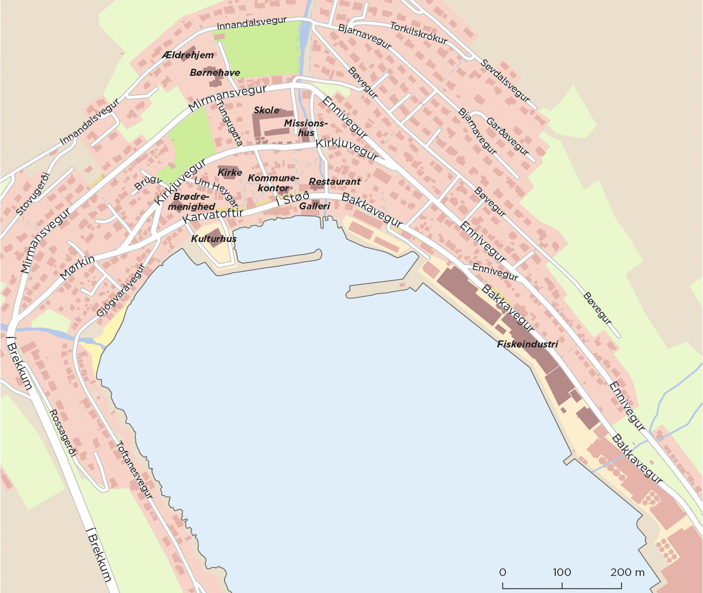
A landing site for large ships was built around 1910. After World War II and in the early 1950s, the port area was expanded considerably to be able to accommodate an increasing number of companies and can now accommodate many moored vessels. Both Faroese and foreign ships regularly call at the port with their catches or to bunker at the oil depot. There is also a port for small boats.
On land, there are production facilities for salmon fry, and on the fjord, there are facilities for salmon farming. A workshop makes fish feeding boats for both the local and the international market. The largest company is the fishmeal and salmon feed factory Havsbrún, which is owned by P/F Bakkafrost. Another company is Pelagos, which processes products from pelagic fish catches for export. In order to obtain adequate capacity of cold storage for the manufactured products, P/F Bergfrost has blasted a cavity in the mountain by the harbour. It has a freezing capacity of 30,000 tonnes.
HAGSTOVA FØROYA
In 1984, the old stone church in Fuglafjørður from 1871 was replaced by a modern church with room for 460 people designed by the Danish architect Holger Jensen. A local builder, Sveinbjørn á Horni, was in charge of the construction. With its excellent acoustics and a 26-stop organ built by Marcussen & Søn, the church is an excellent venue for concerts.
The Thabor mission house was built in 1924. The Brethren congregation’s first meeting hall, Siloa, from 1924 was replaced by a new Siloa in 1992. After the old meeting hall was demolished, a statue of the Brethren preacher Victor Danielsen, who lived in Fuglafjørður, was erected on the site.
The village’s first school was built in 1882. A new one was built in 1936, and from 1958 you could take the qualifying examination. The school has since been expanded several times.
Fuglafjørður is known for having received many foreign fishing vessels already at the beginning of the 20th century, especially from Norway. Therefore, cultural influence from the outside came early in the village in the form of modern dancing and accordion music. The accordion has since been a popular instrument in Fuglafjørður, which also has its own brass band, bands and choirs as well as a theatre association.
A group of private individuals opened a library in 1954, which was taken over by the municipality in 1977. 2002 saw the opening of Mentanarhúsið, a cultural centre which offers a wide range of activities, often in collaboration with Nordens Hus in Tórshavn.
ÍF, Ítrótttarfelag Fuglafjarðar, founded in 1946, was originally a football and handball club, but is now an umbrella organisation for several sports. Fuglafjarðar Svimjiefelag, founded in 1975, and the gymnastics association Flog, founded in 1989, are independent associations. The YMCA and YWCA scouts have a clubhouse in Kambsdalur. The village has a household association, a pensioners’ association and Christian communities within the Brethren congregation and the Evangelical Lutheran Church.
Karvatoftir (Knarratoftir)
Fuglafjørður has a road called Knarratoftir. An old legend has it that Rádni oman Lon owned a knørr (cargo ship), which he sailed to Norway every year to sell his goods. In the winter he pulled up his ship at the place by the beach where he had a neyst or boathouse for his ship. The boathouse is gone, but the name still exists.
Border dispute
Sjúrðargøta is an old path which used to be the main road from Fuglafjørður to the villages on northern Eysturoy. On this path, a dispute about the yield arose between the farmer of Oyndarfjørður, Oyndri, and the farmer of Fuglafjørður, Gullbrandur, and Oyndri killed Gullbrandur with his spiked staff. He hid the body in a cave above Hellur, which is still known as Gullbranshellið, and the place where Gullbrandur was later buried can also still be seen. For his misdeed, Oyndri had to cede his half of the outfield that the two farmers had previously owned together to Fuglafjørður. Therefore, Fuglafjørður owns half of Oyndarfjørður all the way to Laksá, the salmon river, which has its outlet in the middle of the fjord bed.
BASED ON UMHVØRVISSTOVAN
Further reading
- Eysturoy (Island)
- Æðuvík (Settlement)
- Eiði (Settlement) and Eiðis Municipality
- Elduvík (Settlement)
- Funningsfjørður (Settlement)
- Funningur (Settlement)
- Gjógv (Settlement)
- Gøta (Settlements)
- Gøtugjógv (Settlement)
- Hellurnar (Settlement)
- Kambsdalur (Settlement)
- Kambsdalur (Settlement)
- Lamba (Settlement)
- Lambareiði (Settlement)
- Leirvík (Settlement)
- Ljósá (Settlment)
- Nes (Settlement) and Nes Municipality (Eysturoy)
- Norðragøta (Settlement)
- Norðskáli (Settlement)
- Oyndarfjørður (Settlement)
- Oyrarbakki (Settlement)
- Oyri (Settlement)
- Rituvík (Settlement)
- Runavík (Settlement) og Runavíkar Municipality
- Saltnes (Settlement)
- Selatrað (Settlement)
- Sjóar Municipality
- Skálafjørður (Settlement)
- Skáli (Settlement)
- Skipanes (Settlement)
- Søldarfjørður (Settlement)
- Strendur (Settlement)
- Sunda Municipality
- Svínáir (Settlement)
- Syðrugøta (Settlement)
- Toftir (Settlement)
- Undir Gøtueiði (Settlement)
Read more about The islands, towns and settlements