ÓLAVUR FREDERIKSEN, 2009
The landscape and the surrounding seabed reflect the volcanic activity, which, some 61 million years ago, marked the starting point of the formation of the Faroese land area as well as the subsequent extended period of erosion in a climate that gradually became cooler. The erosion of the land area accelerated mainly within the last 2‑3 million years when recurring ice ages and interglacials transformed what remained of the original extensive basalt plain into the 18 small steep islands that make up the Faroe Islands today.
The islands are separated by narrow sounds, which predominantly have a northwest-southeast orientation. While the smallest islands and islets merely jut out of the sea like giant rocks, the larger islands have such vast land masses that more varied landscapes have emerged with inlets, fjords, mountains and valleys as well as local vertical cliffs facing the sea. The landscapes often continue into the sea where they form submarine valleys and ridges as well as a multitude of channels.
The landscapes and their geology
The valleys and fjords are undoubtedly among the Faroe Islands’ most characteristic landscapes. The largest valleys often begin as concave cirque valleys, which over their course turn into elongated valleys with steep mountain sides and wide valley bottoms. Along the coast, the valleys continue as fjords and sounds.
The grassy mountain sides are characterised by bare elongated basaltic lava flows that stretch through the landscape in long, almost horizontal lines. The basaltic lava flows are the remains of the original surface of basaltic lava, which, layer by layer, has built up the Faroe Islands, and which, some 55 million years ago, formed a large, flat basalt plain. Over time, especially during the ice ages, ice, water and wind have eroded down through the old volcanic plain, creating the steep, terraced landscapes that offer a glimpse into the original basalt plain and reveal snippets of the islands’ early history.
The characteristic landscapes
ÓLAVUR FREDERIKSEN, 2020
Of the six geological formations, mainly three form regional landscapes: The Beinisvørð Formation, the Malinstindur Formation and the Enni Formation.
In the westernmost part of the country, particularly on Suðuroy and Mykines, it is the old basalt lava flows of the Beinisvørð Formation that forms the surface. These basalt lava flows were earlier called the lower basalt sequence. The terraced landscapes of the Beinisvørð Formation, which alternate between approx. 20 m thick basalt lava flows and approx. 1 m thick layers of reddish sediments, are clearly seen in the mountainside above Drelnes on Suðuroy.
The characteristic landscapes in the northern part of Suðuroy, Vágar, Streymoy and Eysturoy are made up of the Malinstindur Formation, which forms more coherent landscapes with a less distinct terraced formation. The formation is characterised by many thin basalt lava flows and only few intermediate sediment layers. In addition, porous zones in the basalt are filled with secondary minerals such as zeolites or quartz minerals. These basalt lava flows were earlier called the middle basalt sequence and can be seen in the mountain area around Vestmanna in the northern part of Streymoy where the mountains have a more rounded shape and no or only modest terraced formation.
On large parts of Norðoyggjar (the Northern Islands) and the southern parts of Eysturoy as well as on Streymoy, Nólsoy, Sandoy and Skúvoy, the landscapes are formed by the Enni Formation. The basaltic lava flows, which mark each of the volcanic eruptions that created the formation, are separated by relatively thick, reddish sediment layers and now appear as terraced mountain slopes that alternate between bare, almost horizontal basaltic lava flows and intermediate slopes covered with vegetation. However, the terraces are not as large as in the Beinisvørð Formation on Suðuroy.
Gorges and giant fences
Long gorges can be found everywhere. These gorges, called ‘gjógv’ in Faroese, are eroded fissures and basaltic dikes that extend into the original basalt plain. In some cases, the fissure zones have eroded into deep gorges, where invasion of magma has created transverse basalt columns at the bottom. Frammi við Gjónna at Leynavatn and Gøtugjógv on Eysturoy are typical examples of deep gorges that have formed from the erosion of basaltic dikes.
The intruding magma has created basaltic dikes, which have become more resistant than the surrounding basalt lava flows. In such cases, weathering of the surrounding material can cause the basalt dike to remain as a ridge with horizontal columnar basalts. These ridges are often called ‘jatnagarður’ as they resemble giant fences. An excellent example of a giant fence can be seen at Jatnagarðar on Vágar.
Sloping basalt lava flows
As volcanic activity died out and the erosion of the vast plateau accelerated, the basalt layers began to slope. Today, they typically have an eastern dip of about 2‑4° as can be seen along the fjord Kaldbaksfjørður. Here, it is also possible to follow the boundary between the Malinstindur Formation and the Enni Formation. The boundary is approx. 180 m up in the innermost part of the fjord, while it is at sea level 5 km further out in the fjord.
The remains of the original basalt plain
ÓLAVUR FREDERIKSEN, 2018
Before the beginning of the ice ages 2.6 million years ago, the Faroe Islands were probably one large, more coherent land area with flatter and more open landscapes, while the current long sounds and fjords would have been narrow river valleys. However, as erosion ate away through the basalt plain the original landscape disappeared, and the closest you can get to the old plain landscape today are the flat tops of the islands’ highest mountains.
The highest mountain is the 880 m high Slættaratindur on the northern part of Eysturoy. It is characterised by steep mountain sides, but if you follow the footpath to the top, a bare and windswept plain is revealed covering an area of just under 1,000 m2. Other mountains have even larger flat tops. Among them is the 767 m high Skælingsfjall on Streymoy, whose top forms an approx. 30,000 m2 large plain of old preglacial landscape.
Ice Age landscapes
Through the numerous ice ages over the past 2.6 million years, the Faroe Islands have probably been partially covered by ice between 20 and 30 times. During the last Ice Age, the Weichsel, the ice reached its maximum thickness of approx. 750 m above sea level around Reyðafelstindur in the middle of Eysturoy, which meant that the highest mountain peaks extended above the ice masses as ice-free nunataks. In the shallow part of the Sundalagið sound, where Eysturoy and Streymoy are today linked by a bridge, the ice was divided so that it moved north in the north and south in the south.
The ice slid out through depressions, which were deepened over time into deep, U-shaped valleys with wide bottoms and steep valley sides. As the ice approached the former coastline, the thickness of the ice decreased, so that the higher areas remained ice-free, including the summit of Eiðiskollur on Eysturoy and the highest parts of Nólsoy. On their way across the landscape, the glaciers deepened several large lakes such as Sørvágsvatn (Leitisvatn) and Fjallavatn on Vágar.
In the areas where the landscape was covered in ice, the wear of the ice has rounded the rocks, and you will also find indicator boulders that were transported with the ice. If the rock surfaces have been exposed recently and therefore have not disintegrated, you can often also see glacial scratches, which show the direction of the ice’s movement. These signs reveal that the ice moved out from the Faroe Islands in all directions, which shows that the islands formed an independent glaciation area, which was separated from the ice sheets over Scandinavia, Iceland and Scotland, respectively.
Since many outer coastal landscapes have been heavily eroded by the sea, the valley landscapes were probably much greater during the Ice Age. Examples of such coastal eroded Ice Age landscapes can be seen at Ásmundarstakkur west of Sandvík on Suðuroy and at Tindhólmur west of Sørvágur.
Changes in sea level
Studies of the seabed in the Skálafjørður fjord have shown that, after the last Ice Age, the sea level was so low that the submarine ridge, Saltnesgrynnan, west of Toftir was dry land and that the fjord was a freshwater lake. However, with the melting of the huge ice caps in, for instance, North America, the sea level gradually began to rise, and 7,300 years ago, salty seawater passed over Saltnesgrynnan, transforming the freshwater lake into a fjord.
Despite the rising sea level, the sea level has never been as high as it is today since the last Ice Age, which is confirmed by the fact that coastal lakes such as Gróthúsvatn on Sandoy and Niðara Vatn at Eiði have never been salt lakes. Contrary to Iceland and Scandinavia, which were pressed down by the ice masses of the Ice Age and up to this day have been characterised by continuous postglacial rebound, the same does not seem to be the case in the Faroe Islands. The most likely explanation is that, during the last Ice Age, the Faroese land area was already so small and eroded that the ice masses remained small and light and therefore were not able to press the land down.
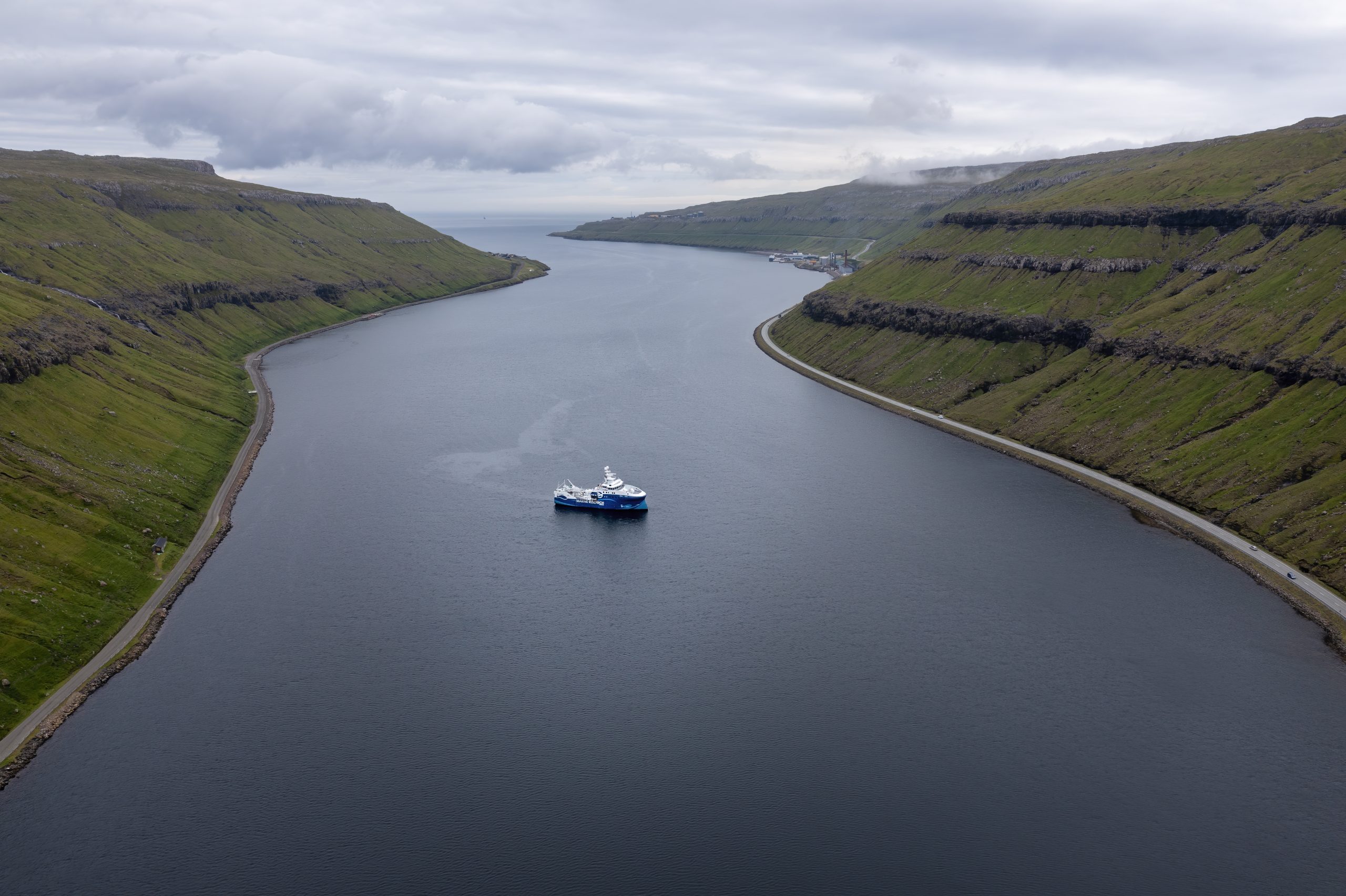
If the area was not pressed down by the ice and thus has had no postglacial rebound, the Faroe Islands must have been affected only by the changes in the sea level of the oceans, which at the end of the last Ice Age was about 130 m lower than today. If the current coastline is moved out to a depth of 130 m, it becomes clear that the Faroe Islands were not an archipelago, but an almost coherent, glaciated land area during the last Ice Age. Fjords and sound formed the lowest parts of the Ice Age landscape, and it was here that small glaciers gathered into larger ones on their way to the former coast. Today’s fjords and sounds should therefore be regarded as flooded valleys, and the sandy and gravelled plains that the meltwater created in front of the glaciers are today below sea level.
An example of a flooded valley is the Kaldbaksfjørður fjord in southeastern Streymoy. During the last Ice Age, Kaldbaksfjørður was a valley with a glacier that reached all the way to the shoulder of the valley. From Kaldbaksbotnur at the bottom of the valley, the glacier moved down through the valley and merged with an even larger glacier in the wide valley which today forms the sound between Streymoy and Eysturoy. The glacier, which was probably the largest in the Faroe Islands during the last Ice Age, continued into the then dry Nólsoyfjørður fjord. From here, part of the ice masses moved south through the fjord, while the rest continued across the low northern part of Nólsoy towards the then coastline, which around 22,000 years ago laid east of Nólsoy.
Although it must be assumed that the Faroe Islands have been through the same number of ice ages and interglacials as the rest of the North Atlantic area, sediments from these periods are rare. An exception is the coastal hill at Borðoyarvík in Klaksvík, which contains material from both the last Ice Age, the Weichsel, and the penultimate Ice Age, the Saale. Between these two moraine deposits are 115,000-year-old seabed sediments from the Eem interglacial, when the sea level was 5‑6 m higher than today.
The high mountains
Today, the climate is predominantly considered as temperate, and in July and August the average temperature in the coastal, grassy landscapes is around 11°C. If you want to experience an arctic climate, you must therefore go up into the high mountains. The air temperature drops by around 0.65°C for every 100 m above sea level, and at an altitude of around 150 m you encounter the 10°C isotherm. Above the isotherm, the average temperature never rises above 10°C in the hottest months of the year, and it thus marks the boundary where the climate changes from temperate to arctic.
Of the total area, only 31 % lies below the 10°C isotherm and thus in the temperate climate zone, while the remaining 69 % reaches altitudes of over 150 m and must therefore be considered as arctic. In these highaltitude areas, the landscapes are in many places characterised by frost weathering, just as frost-sorted gravel forms polygonal grounds and stone stripes. Modest plant growth and high grazing intensity mean that large mountain areas are partially or completely devoid of vegetation. When there are no plant roots to hold the ground on the steep slopes, the frost together with the abundant rainfall and strong winds lead to soil erosion, which frequently turns into landslides and other geohazards.
Today’s coastal landscapes
ÓLAVUR FREDERIKSEN/TRAP FAROE ISLANDS, 2021
The often dramatic coasts offer plenty of opportunities to observe the landscape processes in action. Its location in the middle of the North Atlantic westerly wind belt in combination with numerous low pressure fronts means that the Faroe Islands are often hit by storms with high wind speeds, which create strong surf on the exposed outer coasts. Colloquially, many of these exposed coasts are called brimpláss or surf spots.
ÓLAVUR FREDERIKSEN, 2016
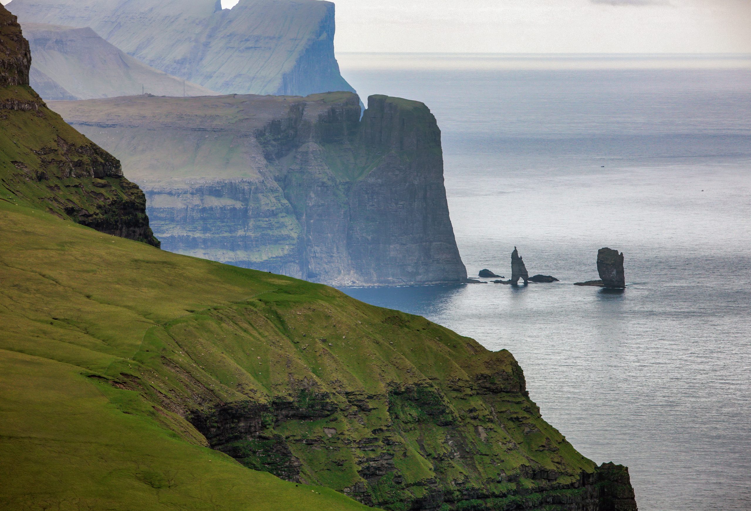
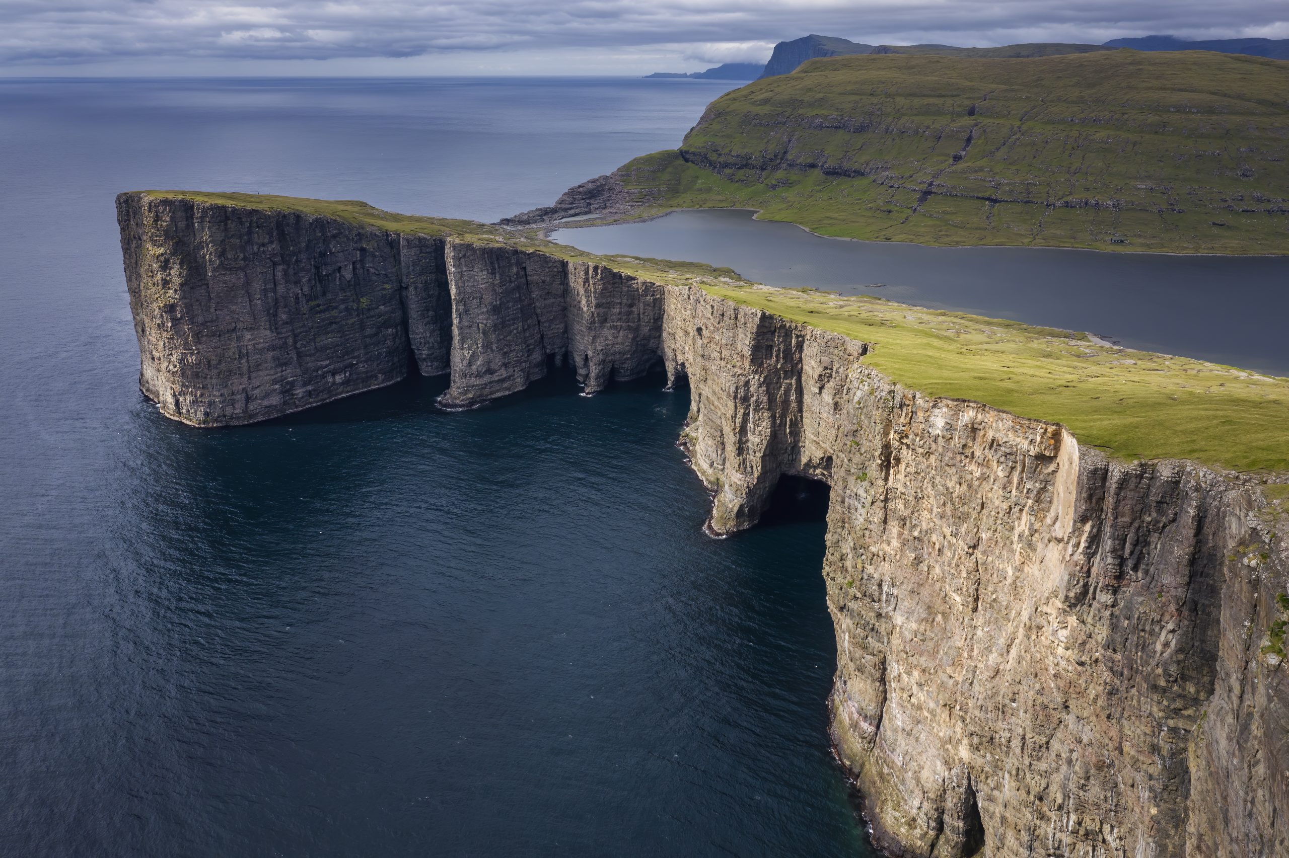
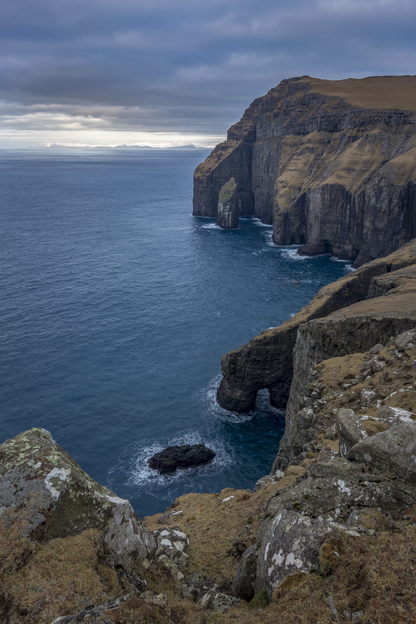
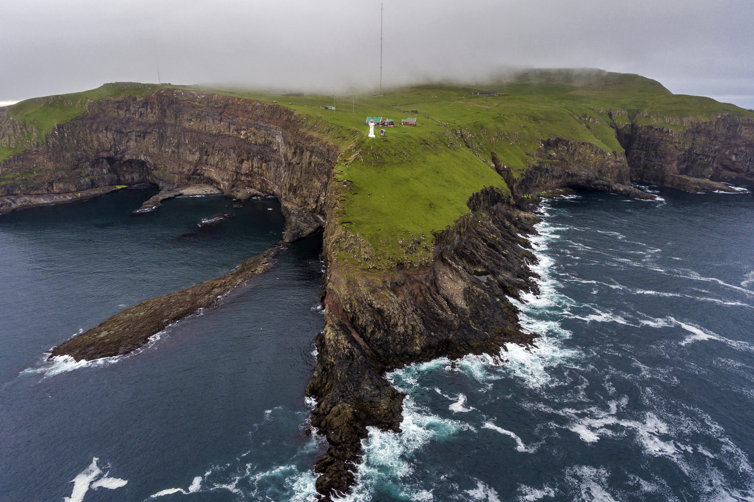
The waves’ constant erosion of the relatively strong basalt has shaped the several hundred meter high vertical cliffs that characterise many of the outer coasts. To the west, very high cliffs can be seen on the coasts from Suðuroy to Lítla Dímun, Stóra Dímun, Skúvoy, Sandoy, Hestur, Koltur, Vágar and Mykines, and the steep cliffs of Vestmannabjørgini and Saksunarbjørgini are characteristic of the coast of Streymoy west of Vestmanna and Saksun, respectively. Also, in the north, on the area from Mykines to Vágar, Streymoy, Eysturoy, Kalsoy, Kunoy, Borðoy, Viðoy and Fugloy, high cliffs can be seen along the wave-exposed outer coasts. The Faroe Islands’ highest cliff is the 754 m high Enniberg on Viðoy’s north coast. It is also the second highest coastal cliff in Europe, surpassed only by Hornelen in Norway.
The surf towards the western and northern outer coasts can be so heavy that storm surfaces are formed, which are small coastal platforms that lie just above normal sea level. They are formed by erosion from the heavy surf that can occur when sea levels rise during a low pressure front that is accompanied by a storm. Sea stacks in the form of the flat-topped ‘stakkur’ can often be seen on the storm surfaces, and since the flats are just above sea level, they stand on dry land when the weather is calm, as can be experienced at Mykineshólmur and on the west coast of Hestur. The storm surfaces resemble the raised coasts that can be seen in, for example, Iceland and Norway. However, the fact that the Faroese storm surfaces are located in some of the most energetic surf environments and never in calm waters makes it highly unlikely that the coast should be raised.
In areas where the coasts are sheltered, the slopes continue more evenly into the sea, and the vegetation often stretches right down to the beach. In many places, these coasts also resemble Ice Age landscapes. For example, you can find thin but clear glacial scratches, which show that the coast has remained more or less intact since the last Ice Age, and that wave erosion has been modest.
Further reading
- Akraberg
- Geology on the Faroe Islands
- Hvannhagi
- Nature and environmental management
- The sea around the Faroe Islands
Read more about Nature and landscape on the Faroe Islands