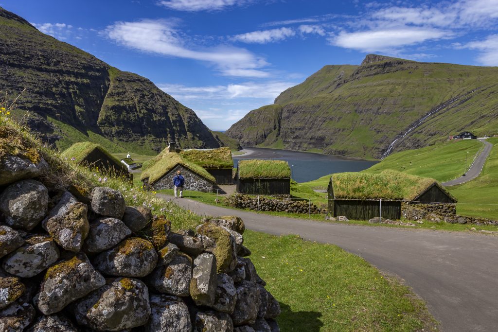
Streymoy, northern part
At 374.9 km², Streymoy is the largest island in the Faroe Islands. On the west side of Norðurstreymoy, the northern part of Streymoy, lie the markatal settlements of Saksun, Vestmanna, Kvívík, Leynar and Skælingur and the outlying villages of Válur, Nes and Stykkið, and, on the east side lie Kollafjørður, Hósvík, Hvalvík, Streymnes, Haldórsvík and Tjørnuvík and the outlying villages of Langasandur and Nesvík.
Norðurstreymoy is part of the district Streymoyar sýsla and is divided into an eastern and a western superior parish. The area constituted one municipality until 1892. Vestmanna became an independent municipality in 1892, and other villages soon became independent municipalities as well. Norðurstreymoy now includes Vestmanna, Kvívíkar and Sunda Kommuna. For centuries, Kollafjørður has been considered part of Norðurstreymoy. It has now merged with Tórshavnar Kommuna. Sunda Kommuna includes villages on both Norðurstreymoy and Eysturoy.
Norðurstreymoy’s west side towards Vágar is grass covered towards the coast from Skælingur to somewhat north of Vestmanna, but then the landscape changes drastically to the northwest, where Vestmannabjørgini and Saksunarbjørgini rise vertically to several hundreds of metres. In the mountain gorges, the steep rock walls are interrupted by overhangs with many seabirds and large grassy skorar (rock ledges) where sheep graze in summer. You can sail into the gorges by boat.
The east side towards Sundini, the sound between Streymoy and Eysturoy, mainly consists of grassy moraine hills where the grass goes all the way down to the beach. Streams run down to the sea on both sides of Norðurstreymoy. You are never far from the sea in the Faroe Islands, but at Fjallið Lítla at Saksunardalur, the distance is the furthest at around 6 km.
The highest mountains north of Vestmanna are Koppenni at 789 m, Ørvisfellið at 783 m and Malaknúkur at 777 m; the 767-m high Skælingsfjall rises at the village of Skælingur, and southwest of Tjørnuvík you can see the Melin at 764 m.
Streymoy, southern part
The southern part of Streymoy includes the markatal settlements of Kaldbak, Hoyvík and Tórshavn with the new outlying village or suburb of Norðasta Horn on the western side and the outlying village of Hvítanes. On the western side, the region includes the markatal settlements of Norðradalur, Syðradalur, Velbastaður and Kirkjubøur. Together with Tórshavn, these villages constitute the capital municipality of Tórshavnar Kommuna, which also includes the islands of Nólsoy, Hestur and Koltur and village of Kollafjørður on Norðurstreymoy.
Further reading
Read more about The islands, towns and settlements