
Ørðavík, referred to in Hundabrævið, is located on the southern side of Trongisvágsfjørður and reaches all the way to the head of the fjord via Ørðavíkarlíð. The sheep herd consists of 480 animals.
Ørðavík itself has 30 inhabitants and covers 12 merkur. 8 mercury and 10 gyllin are copyhold land divided between five copyhold tenants; 3 merkur and 6 gyllin are freehold land. Originally, the village had two býlingar: við Á and uppi á Bø. Although there are no dairy cows on Suðuroy, there is calf rearing facility in Ørðavík.
In Ørðavík at Tinggil uppi millum Stovur, the old thingstead of Suðuroy is found. The thing later assembled indoors in the farmhouse Uppi í Stovu in Ørðavík. Skarpheyggjar (derived from the Faroese word for executioner) and Gálgatangi are not far away, just like Tjaldavík, where people assembled spent the night in their tents. Outside this bay lies the uninhabited islet of Tjaldavíkshólmur.
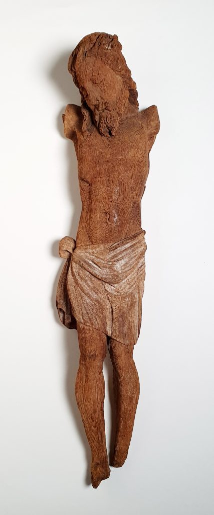
At the old thingsted, traces of buildings have been found that indicate a seasonal trading post in a small natural harbour, Krambatangi. The name suggests that it was the activities of German or Dutch merchants. A number of objects were also found, e.g. a figure of Christ, believed to be from the 16th or 17th century.
In the Middle Ages, Ørðavík had a house of prayer, and in 1966 the village got a new one designed by Mortan Winther Poulsen.
In Ørðavíkarlíð, a cemetery was built around the year 1900. At Drelnes there is a port facility with an old salt silo, which today houses the municipality’s and the island’s cultural centre SALT. At Krambatangi there is a ferry landing for the ferry that operates between Tvøroyri and Tórshavn.
Veittrasteinur (Stone of The Spirits)
When the road between Ørðavík and Hov was built in 1959, there was a large stone in the middle of the planned roadway at the stretch within Tjaldavíkshólmur. The Danish road engineer wanted to blow up the stone with dynamite. However, the local road workers told him that the stone had always been respected there because it was supposed to be íbygdur: populated by supernatural beings who should be given peace so that they would not take revenge. The engineer was not superstitious and decided to blow up the rock. After repeated detonation attempts, with the fuse going out each time, the engineer finally gave up. The road was established around the stone in an S shape, and the stone is still there.
Further reading
- Víkarbyrgi and Hamrabyrgi (Settlements)
- Vágur (Settlement)
- Tvøroyri (Settlement)
- Tvøroyrar Municipality
- Trongisvágur (Settlement)
- Sumba (Settlement) and Sumbiar Municipality
- Sandvík (Settlement)
- Porkeri (Settlement)
- Nes (Settlement)
- Lopra (Settlement)
- Hvalba (Settlement)
- Hov (Settlement)
- Fámjin (Settlement)
- Froðba (Settlement)
- Akrar (Settlement)
- Suðuroy (Island)
Read more about The islands, towns and settlements